Mozambique fire activity: satellite footprint reaches 317,489 hectares
FIRE ACTIVITY / SATELLITE MONITORING
What changed
First retained snapshot
No earlier verified snapshot is present in the recovered dataset. This record remains available as the historical baseline.
Situation
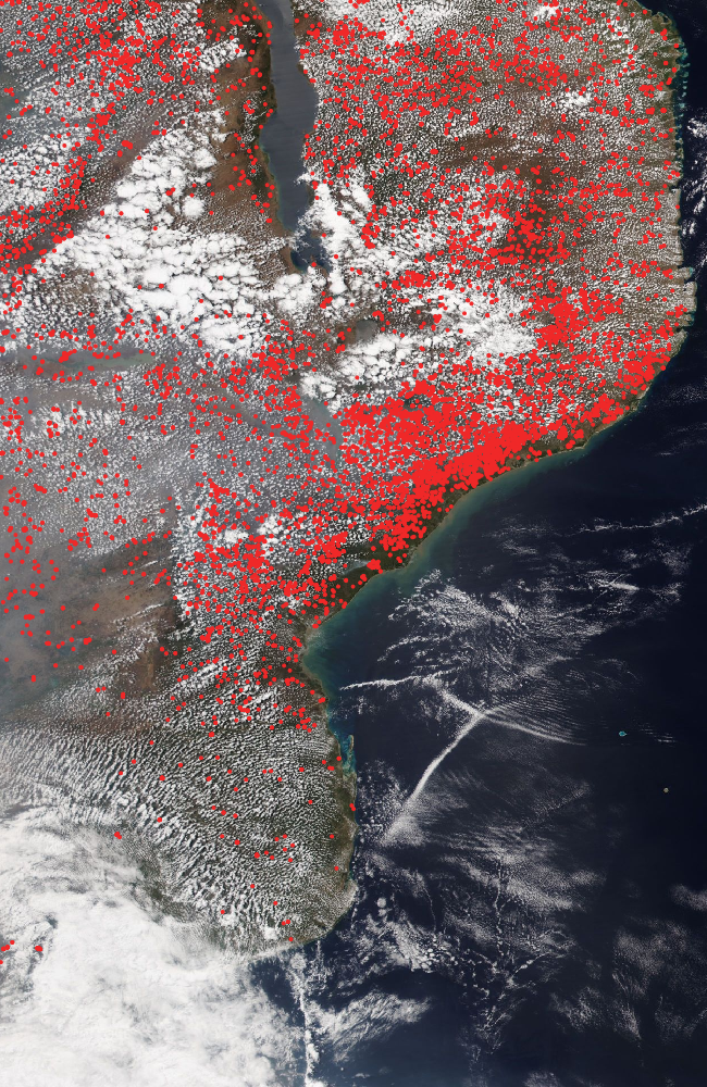
GDACS retained a Green alert for fire activity in Mozambique. Its satellite-derived event footprint covered 317,489 hectares between 3 and 18 September 2026, with an estimated 97,758 people living inside the burned-area footprint. That exposure estimate is not a confirmed count of people harmed or displaced. The accompanying NASA Worldview image combines NOAA-20 VIIRS true-colour imagery with thermal-anomaly markers; hotspots can include agricultural or managed burns and should not be interpreted as ground-verified wildfire damage.
Verified figures
- Satellite-derived burned-area footprint
- 317,489 hectares · GDACS, 18 September 2026 retained at 2026-09-19
- Population inside footprint
- 97,758 estimated people · exposure, not confirmed victims retained at 2026-09-19
- Detection period
- 3–18 September 2026 retained at 2026-09-19
What we knew when
- WorldsAid record entered the retained historical dataset.
- GDACS Green alert; satellite-derived footprint and exposure retained with methodology caveat preserved as a dated, source-linked observation. Source
Earlier figures are never replaced by later values; additional observations are retained as new ledger entries.
Provenance
This page renders the last verified WorldsAid cache directly in HTML. It does not treat generated summaries as primary evidence.
Cached dataset: worldsai_drup771.sql.gz
Record SHA-256: 6fc108087bd9ddc58e75c509d503d242e72a4bd54b0cc9801090cc2b23107d45