
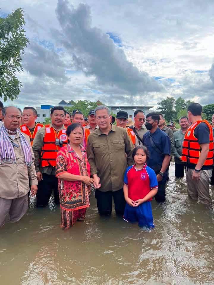
Floods affect nearly 45,000 families across 10 Cambodian provinces
Flood
How the score is calculated
The score starts at 8. It adds points from recorded affected, deaths, displaced and casualty counts, plus terms found in the story title, event type or status. For each count, only its highest matching band is used.
- Affected people
- 1–999: +5 · 1,000–9,999: +12 · 10,000–99,999: +20 · 100,000–999,999: +28 · 1 million+: +35
- Deaths
- 1–9: +8 · 10–99: +14 · 100–999: +22 · 1,000+: +30
- Displaced people
- 1–9,999: +6 · 10,000–99,999: +12 · 100,000+: +18
- Casualties
- 100 or more: +8
- Story wording
- +10 for terms such as catastrophe, famine, war, conflict, major earthquake, mass casualty or critical. Otherwise, +5 for active, ongoing, emergency, outbreak, cyclone or hurricane.
Score bands: Watch 0–24 · Moderate 25–49 · High 50–74 · Critical 75–100. Scores are capped at 100. Missing or unparseable figures add no points.
This is a rule-based WorldsAid triage indicator, not an official or independently validated classification. It does not account for recency or local context, and it can understate events with incomplete reporting. Check the linked sources.
In brief
- What happenedHeavy rainfall has caused flooding across 10 Cambodian provinces since early September; reporting also notes peripheral influence from Typhoon Surigae, without evidence of a direct cyclone landfall.
- Reported impactNCDM-attributed families affected: 44,889 · assessment as of 27 September · Families evacuated: 3,685 · NCDM-attributed assessment · Houses affected: 40,384
- What help is neededResponse priorities should be confirmed in the linked source reports as needs change.
What changed
Updated verified snapshot
This record was first dated 2026-09-08 and last verified 2026-09-28.
Situation
Heavy rainfall has caused flooding across 10 Cambodian provinces since early September; reporting also notes peripheral influence from Typhoon Surigae, without evidence of a direct cyclone landfall. As of 27 September, an NCDM-attributed assessment reported 44,889 families affected, 3,685 families evacuated, 40,384 houses affected and 49,925 hectares of rice fields affected.
Agence Kampuchea Presse separately reported on 28 September that about 44,800 families were affected and around 3,600 families evacuated. These are separate attributed observations with slightly different rounded counts; they are not combined. Family counts are not converted into people, and the cited reports do not establish a casualty total.
WorldsAid verification
A WorldsAid editor reviewed this record against 2 attributed sources, cleaned feed formatting and checked the crisis, place and reporting date. 8 human-impact figures were separated from the narrative and dated where the source allowed. Earlier observations remain in the evidence history instead of being silently overwritten.
Verified figures
- NCDM-attributed families affected
- 44,889 · assessment as of 27 September retained at 2026-09-28
- Families evacuated
- 3,685 · NCDM-attributed assessment retained at 2026-09-28
- Houses affected
- 40,384 retained at 2026-09-28
- Rice fields affected
- 49,925 hectares retained at 2026-09-28
- Geographic scope
- 10 provinces retained at 2026-09-28
- Separate AKP report
- About 44,800 families affected / around 3,600 families evacuated on 28 September retained at 2026-09-28
- Casualties
- No casualty total established in the cited reports retained at 2026-09-28
- Scope note
- Family totals are not converted into people; parallel reports are not combined; peripheral rain influence is not direct cyclone landfall retained at 2026-09-28
What we knew when
- WorldsAid record entered the retained historical dataset.
- NCDM-attributed assessment: 44,889 families affected; 3,685 families evacuated; 40,384 houses; 49,925 hectares of rice fields affected across 10 provinces. preserved as a dated, source-linked observation. Source
- AKP separately reported about 44,800 families affected and around 3,600 evacuated across 10 provinces. preserved as a dated, source-linked observation. Source
Earlier figures are never replaced by later values; additional observations are retained as new ledger entries.
Provenance
This page renders the last verified WorldsAid cache directly in HTML. It does not treat generated summaries as primary evidence.
Cached dataset: worldsai_drup771.sql.gz
Verified
SHA-256 93b1278acd14daf5e3648564f630db4deec7665bf826b8688aafc39d2fde6b0c